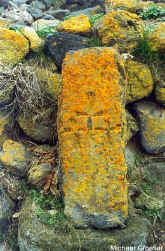
Next   is    Nerkin    Sasunashen (formerly Gharagonmaz) with the foundations of a small 7th c. church on a beautiful promontory at the SW end of the village beyond the cemetery. There are traces of substantial Iron Age fortifications closing off the promontory, and caves  in  the  gorge  below.  A   series

   The  paved  road  continues   across the gorge and up to Verin Sasunashen, allegedly with cyclopean fort ruins. The road ascends temptingly, paved with rough cobbles, deep into the Aragats highlands.

UNDER CONSTRUCTION

of left  turns  from  the village council building leads to the battered walls of a second early church. Continuing NW through the village, a bad road to the right at the far end leads to the simple granite marker commemorating the crash site of 17 U.S. Air Force personnel shot down by Soviet MIG fighters on September 2, 1958 when their C-130 electronic intelligence plane strayed across the border from Turkey. Six bodies were returned in September 1958, and a USAF team recovered additional remains in the 1990s.