|
|
Shortly
after
Dzorakap, a
side road angles back SE toward Sarnaghbyur.
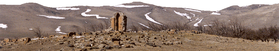
About 1 km on the right is the Hogevank
monastery complex, primarily of the 13th c.
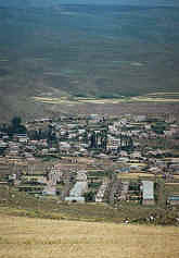
Beyond a dam and reservoir rises the village of
Sarnaghbyur
(“Cold Spring”, till 1940
Sogutlu or Ghzlkilisa).
This
venerable
village derives its name and antiquity from a cave at the back of
the |
|
Opposite
a
huge
cotton
spinning factory on the edge of Maralik, a decent paved road
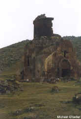
departs the main Gyumri highway W, bound for Artik. On the W approaches of
Pemzashen
(“Pumice built”) is the 11th c. Arakelots
vank (dirt road to
right).
Note at the road’s
closest approach to the
church an interesting
massive carved tomb shrine. Back
on the main road, turning
|
|
|
village from which flows an ample spring believed to have
mystical healing powers.
Now walled up (key in house on right), the cave houses a
shrine of Gregory the Illuminator.
The cave is reached by proceeding through the village
(note ornate carved fireplace in ruined house on left) to the
substantial S. Tadevos church of 1883, before which one turns
left, then the first paved right turn.
There is reportedly also a ruined 5-6th c.
church of S. Hakob and a S. Karapet church of 1205.
On a hill 6 km E is S. Ghazar ruined church of the 5-6th
c. There are three Iron
Age cyclopean forts in the vicinity.
|
|
right and right again into
the village, there is a decorated 7th c. ruined church built abutting the foundations of a 5th c.
basilica. Continuing past this church up the hill in the direction
of Lernakert, you pass Makaravank, dating to the 10-13th c, with S. Sion church
of 1001. In the gorge below the monastery, reached by a steep,
rock-cut path is an 18th c. small church built on
earlier foundations, and a hermit’s cell (?) cut in the cliff. |