|
|
At
9.1 km is the first turnoff to the right for Shatin. At
10.0 km from the Yeghegnadzor road is the second turn-off for
Shatin, (till 1935 Hasankend), where the
Yeghegis river turns E. Main attraction is
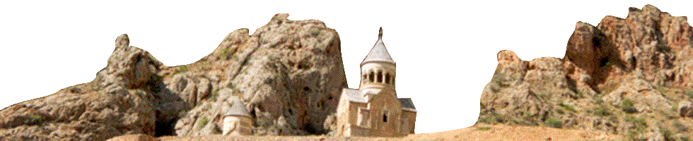
Shativank, a fortified monastery
3 km E up the gorge.
Other
antiquities in the
vicinity
reportedly include Berdakar
fort (2
km S, 5th c.), |
|
At the first fork
beyond Shatin, signposted “Tsakhatskar Vank 13
km”, turning left (N) on a paved road brings one to Artabuynk
(until 1946 Erdapin, then Yeghegis until the
recent transfer of populations, when Alayaz reclaimed the name). Its
inhabitants were brought in 1830 from Khoy
region. Follow the lower road parallel to the
stream until about 1 km
|
|
|
Shatin
bridge, a shrine S, and a 10th
c. church in Hostun.
|
|
past the village. An unmarked jeep track
angles steeply down to the right, fords
the stream, and climbs up. The left fork (and left again) leads (6 km NE
of village) to the splendid ruined Tsakhatskar Monastery, with S. Hovhannes church of 989, S. Karapet
church of the 10th c., and a host of other ruined buildings,
decorated with splendid khachkars, on the flank of the mountain. Retracing the track and taking the first right fork leads to the
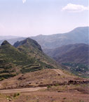
9th century fortress of Smbatabert. This spectacular castle sits on the crest of the ridge between
Artabuynk and Yeghegis (or, as most people still call them, Yeghegis and
Alayaz), and includes an upper citadel. The castle
recieved water from a buried clay pipe leading from
the monastery. According to legend, the Turks compelled the fort’s
surrender
by employing a thirsty horse to sniff out the pipeline. |